How to get topographic data Airflow Simulation
Hello,
When you are doing a wind simulation for the first time, you may wonder how to prepare the 3D terrain data of the target area.
Wind simulation is a method for analyzing wind flows that are complicated by topography and buildings.
Therefore, the reliability of the analysis results is highly dependent on the level of detail and accuracy of the original 3D information.
I would like to discuss the highly accurate “topographic data” available for wind simulation in this column.
The general CFD topographic data preparation procedure involves the following steps;
- 1) Download digital elevation model data published by the Geospatial Information Authority of Japan.
- 2) Modeling the three-dimensional terrain shape by processing mesh data with CAD
- 3) Convert the model data to a format (e.g., STL format) that can be handled by wind simulation software.
- 4)The topographic model is arranged according to scale and location to generate a computational grid for fluid simulation.
On the other hand, what does the terrain preparation process look like in Airflow Analyst?
ArcGIS Pro automatically downloads the best elevation data distributed by ESRI and displays it as a layer that can be used for analysis.
Airflow Analyst allows you to “Just start ArcGIS Pro,” and you are ready for optimal terrain data.
The user sets up a computational grid where they want to analyze wind conditions, and the analysis can be performed using the topography at that location.
In addition, if the user wants to consider the influence of trees and buildings at the location, the preparation is complete by preparing and adding structure and tree data.
We will discuss obtaining this building and tree data in the next issue!
1.ArcGIS “World Elevation 3D” Layer
The first one is to use the elevation surface layer called “World Elevation 3D” included in ArcGIS Pro, which is the most important part of utilizing topographic data.
This layer comprises the best elevation data and seamlessly delivers data from various countries with resolutions from 0.25m to 10m.
In Japan, this includes 5m mesh elevation and 10m mesh elevation provided by the Technical Report of the Geospatial Information Authority of Japan (GSI).
With ArcGIS Pro, this ground surface is displayed by default in the local scene and is immediately available for use.
The best solution is to use this topographic data for wind analysis if there is a special reason not to.
Another major advantage is that there is no need to download or convert data in preparation, and the user can use it immediately, anywhere in the world.
When you use AirflowAnalyst, we recommend checking this “ground surface” first.
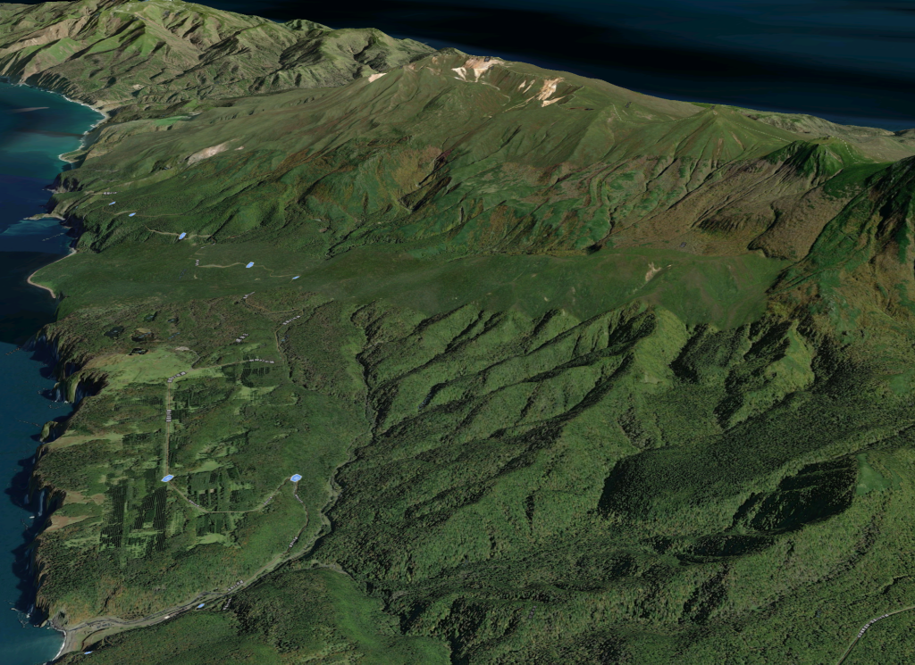
Let’s take a visual look at the actual default elevation data quality.
When the GSI Tiles (Online Basemap) are displayed as a texture on the “World Elevation Map” layer, it is clear that the topographic data is quite precise.
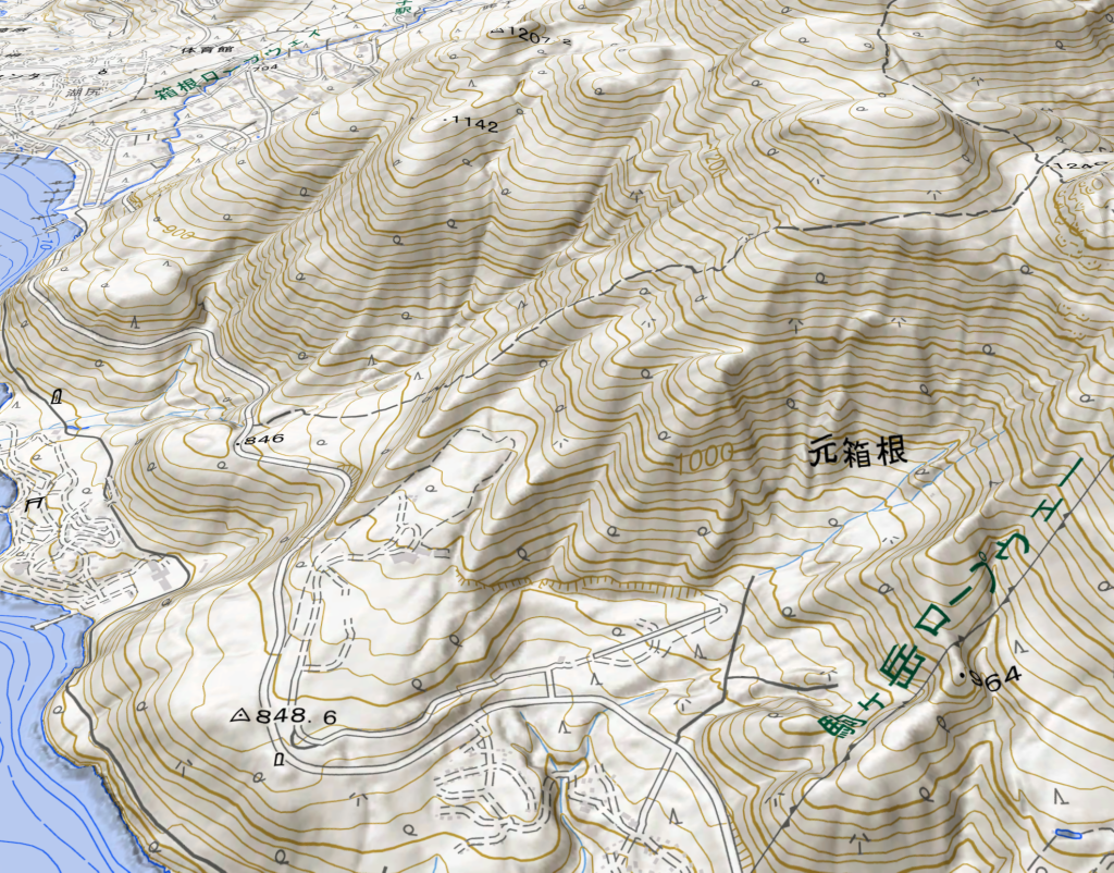
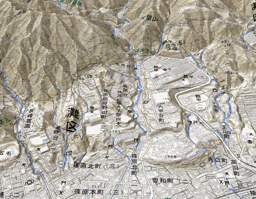
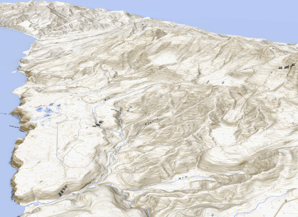
Another advantage of ArcGIS Pro is that you can see the actual land cover by overlaying aerial and satellite photos, which are free of charge in ArcGIS Pro.
At the address below, you will find data resources for each country in the “WorldElevation3D” layer distributed by ESRI.
Reference contents of ground surface data (External Site)
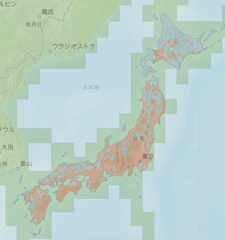
The type of world elevation mesh included in WorldElevation3D is shown in the map below.
In Japan, blue areas are provided at 10m mesh and red areas at 5m mesh.
2.AW3D high-definition topographic data
AW3D is an elevation product created using high-resolution satellite imagery marketed by RESTEC.
The technology combines multiple high-resolution satellite images to generate detailed terrain.
It is unique in its ability to create detailed terrain without blind spots, even in complex terrain and urban centres.
The resolution is very fine, ranging from 0.5 to 2 m, and can be acquired worldwide (provided that the area has been previously imaged by satellite).
In terms of accuracy, the position and height accuracy is equivalent to that of a 1/2,500 topographic map.
General wind analysis rarely requires such detailed topographic undulation data.
However, in civil engineering design, operators can use AW3D as an alternative to topographic surveying, and it is useful for simulating wind conditions after terrain modification.
It can also be useful for overseas projects where detailed topographic data is unavailable locally.
Please contact us if you are interested.
AW3D Web site(External Site)
3.Topographic data photogrammetrically surveyed by drone
Very detailed terrain data can be obtained by using a drone to photograph the target area and then analyzing the images with software such as ESRI’s SiteScan and Drone2Map.
This photogrammetry technology enables the production of terrain data within a resolution of 10 cm, allowing analysts to simulate wind conditions based on fine-scale terrain and landforms.
ArcGIS Reality(External Site)

Drone2Map (Extermnal Site)

Elevation data generated from drone photographs are highly detailed and can capture rocks, topography, roof profiles, and even tree canopy shapes.
Airflow analysis based on such surface models can be used to assess how, for example, tree felling will change the wind flow.
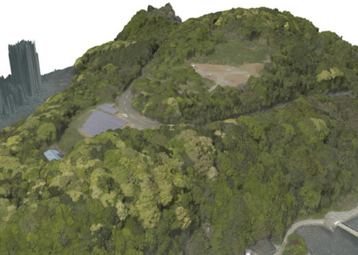
The advantage of the drone photography approach is that the terrain can be captured on the day of the photograph.
Drones are an option for analyses where up-to-date and detailed undulation data is important.
However,laws restrect drone flights in some areas. In addition, the area that can be covered in a single day of filming is limited to a few square kilometers, which means that wide-area filming is limited.
Drone technology assumes that the conditions for photography are compatible with the purpose.
Our Company also offers a product for generating terrain through drone photo analysis.
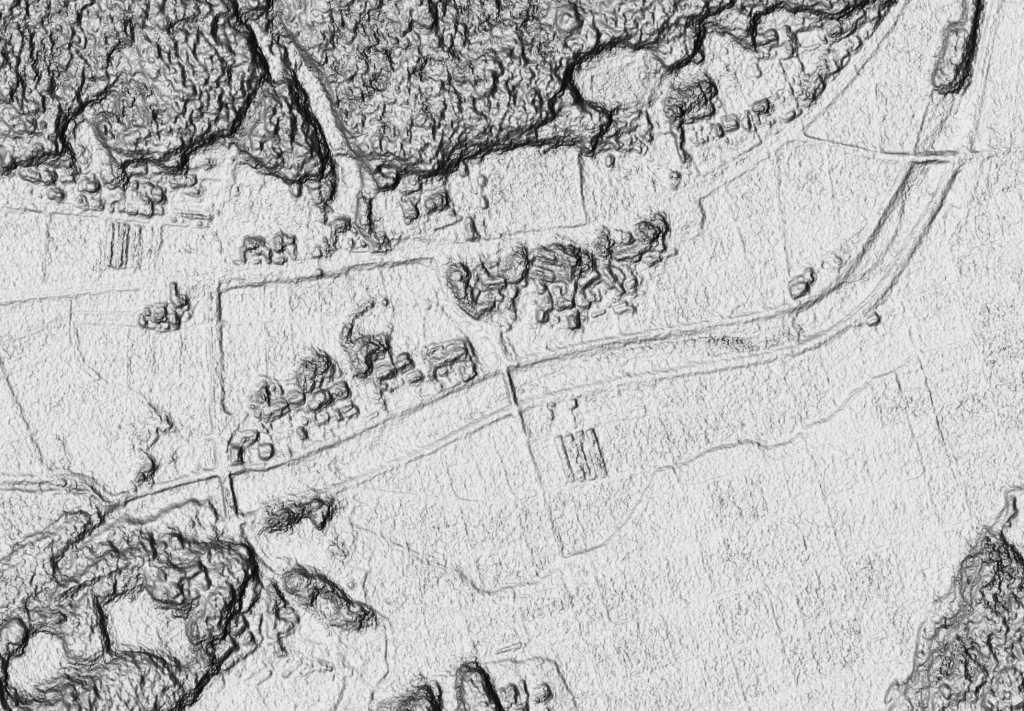
4.Topographic data from point cloud data
In recent years, point cloud data acquired by aircraft or on the ground using laser scanners has become available as open data.
Highly accurate ground surface data can be obtained from such data.
Distinguishing between surface and other points requires skill, but ArcGIS Pro’s new features include a suite of AI-based functions to automatically classify them.
As point cloud data coverage expands, point cloud data resources will become the terrain data for wind simulation.
Conclusion
These are some of the options for terrain data. There may be other methods for terrain options.
The wind simulation tool aims to optimize the proposed plan based on the results. In preparation for this, I would like to make a choice that optimizes and minimizes the effort for terrain development.
We hope you find this information helpful.
Airflow Analyst評価版ダウンロード
体験期間:約1ヵ月
体験版と製品版の違い:計算できる格子数に制限あります。
動作条件:
・ArcGIS Pro3.0以上
・OpenGLで動作するグラフィックボード
・メモリ12GB 以上推奨